Saturday, September 16, 2006
Backpacking September 2006
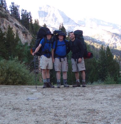
The team: Bob, Jonathan, and Jonathan's classmate Chris_2
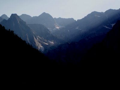
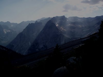
We took the classic South Lake to North Lake semiloop. We had contemplated going over the Glacier Divide by one of the three cross-country routes (The Keyhole, Alpine Col, or the dreaded Snow-Tongue Pass), but a merited concern about exceptional snow on the shady north side of the divide made us go the long way around, by the Muir trail and the Piute Creek trail.
The itinerary:
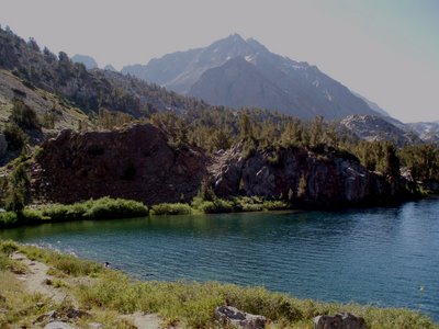
Day 1: Early departure from South Lake, easy ascent of Bishop Pass, down the Dusy branch of the Middle Fork of the Kings River to camp above Le Conte Canyon.
Day2: Up Le Conte Canyon to camp below Helen Lake. We quit early because of rain, which did not last long.
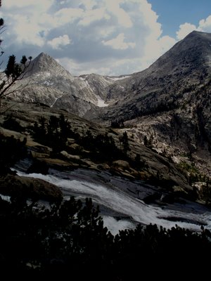
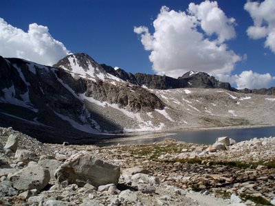
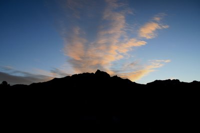
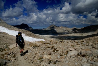
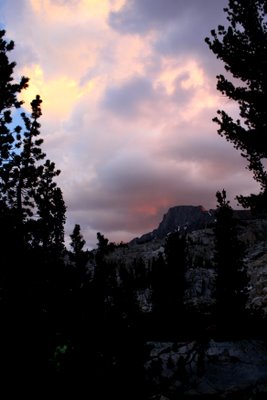
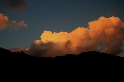
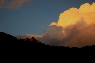
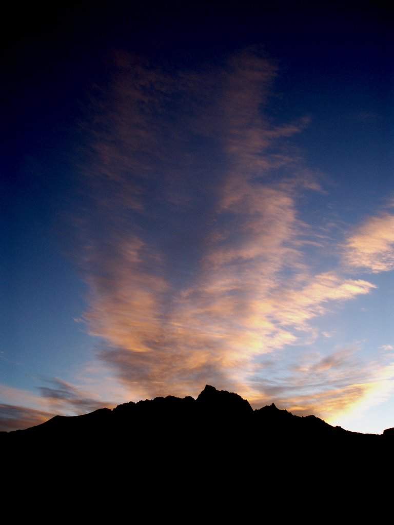
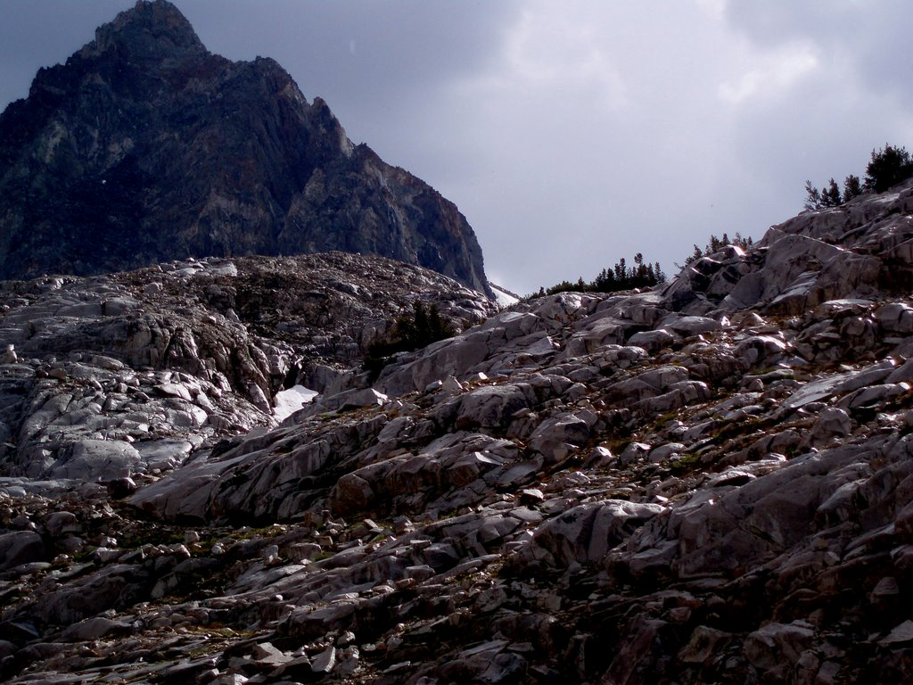
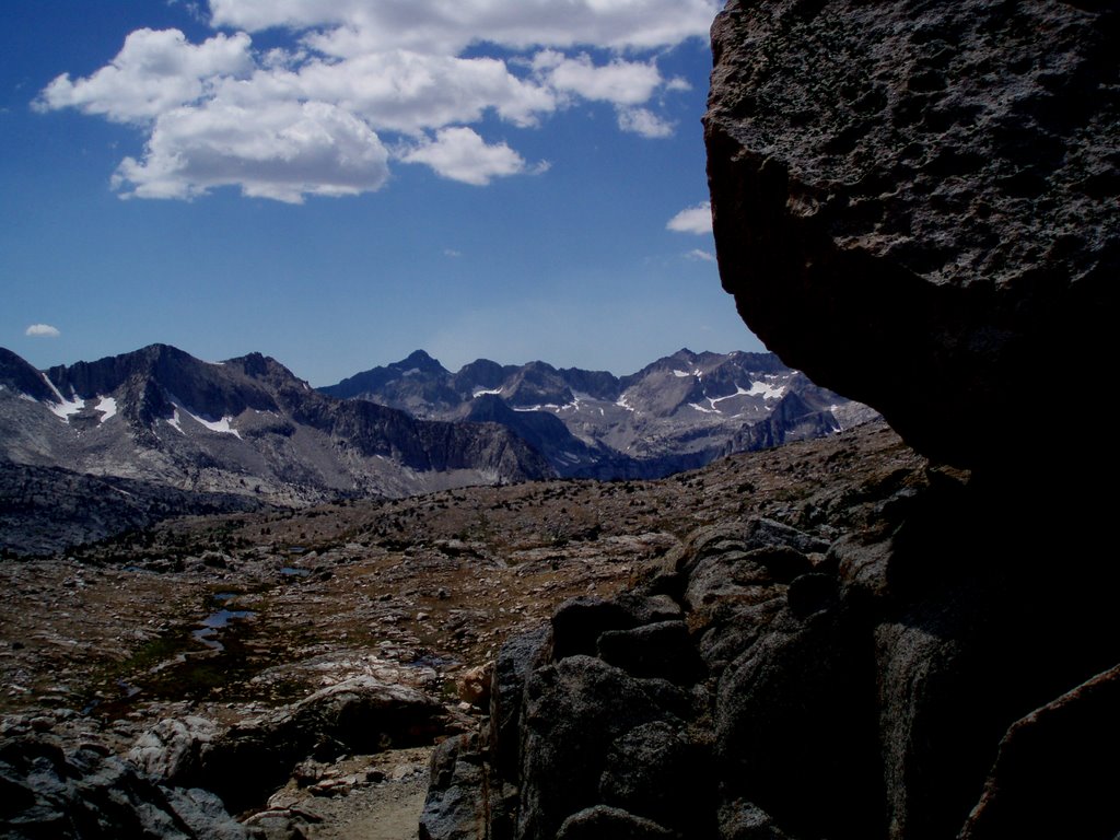
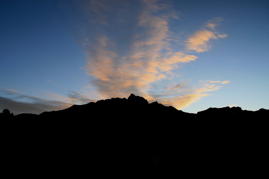
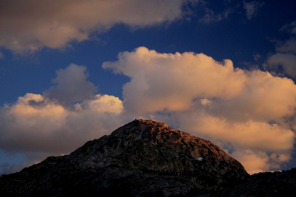
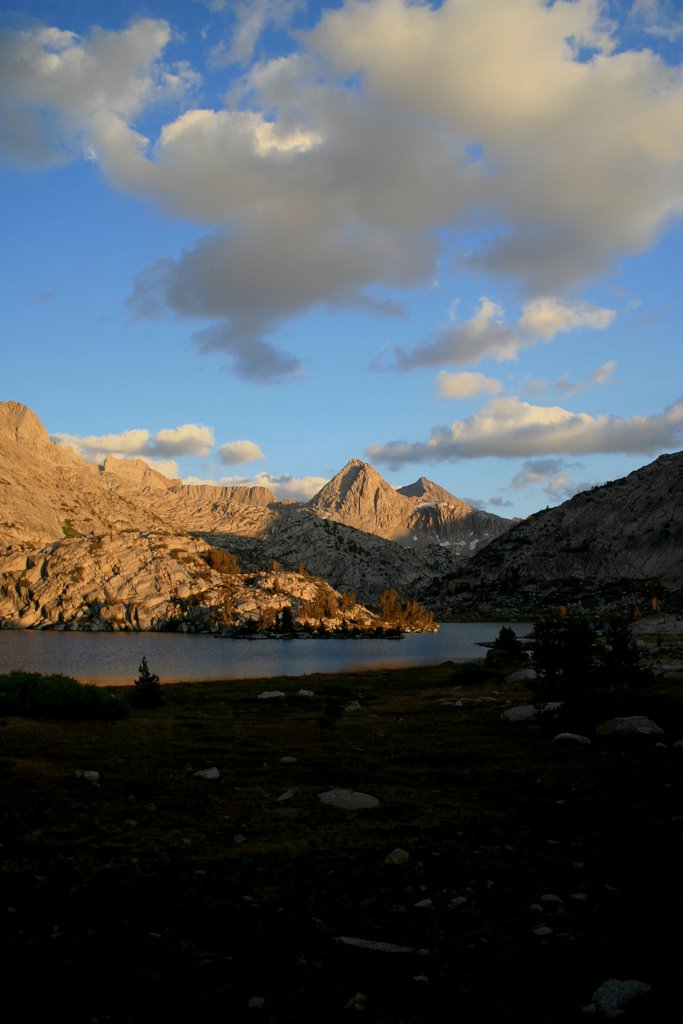
Day 3: Over Muir Pass, down Evolution Basin, to a beautiful camp at the far end of Evolution Lake. Climbed a nearby knob for a breathtaking view down Evolution Valley after making camp. Had some rain in the afternoon on the trail.
Day 4: Down Evolution Canyon to camp at the confluence of the South Fork of the San Joaquin River and Piute Creek, a crowded location more like a campground than backpacking.
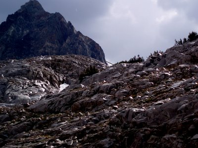
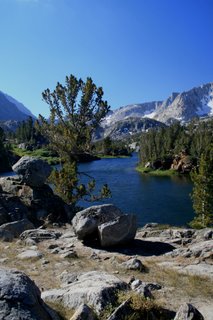
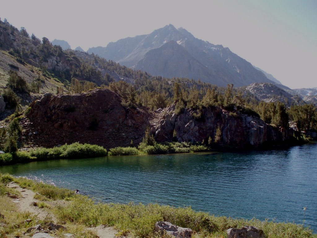
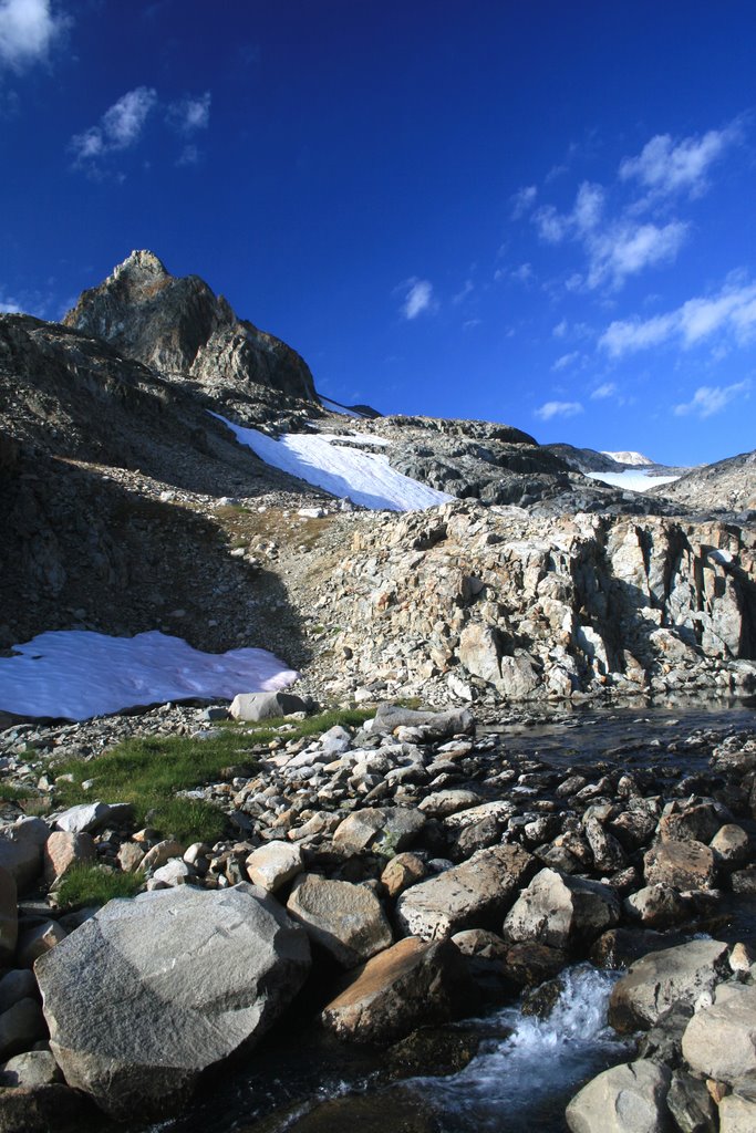
Day 5: Up Piute Creek to a splended camp above the point where the Piute Pass trail crosses the outlet creek from Cony Lake. This camp is worth searching out--it's not visible from the trail. It's at about 11,200 feet and seriously cold in September--water bottles left outside tents froze totally solid.
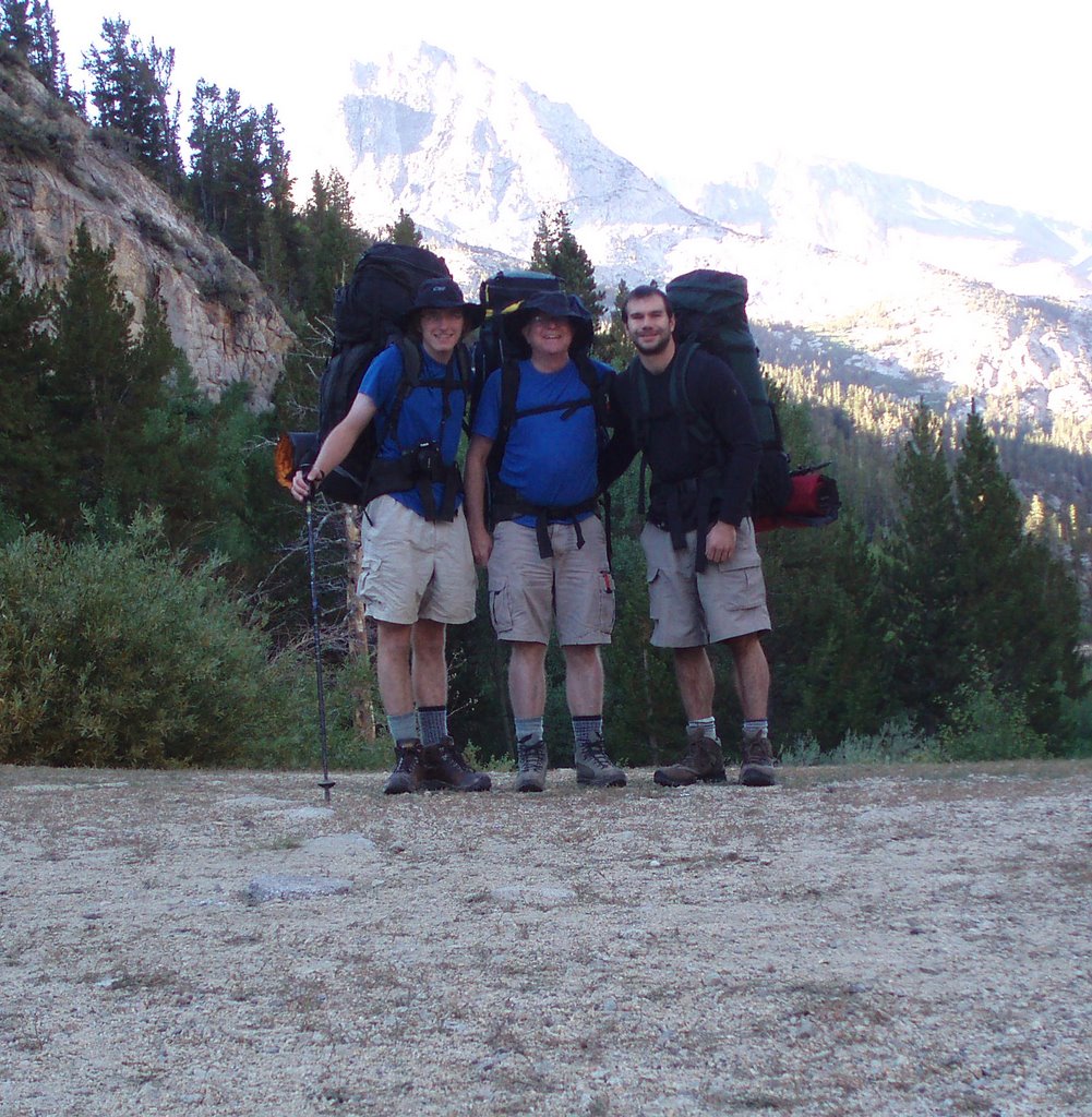
Day 6. Chris_2 left early, raced out to the North Lake trailhead, picked up the bicycle we had cached there, rode down to the South Lake road, tried pedaling up some of the 2000 vertical feet, thought better, and got a ride from some friendly fishermen. He drove the truck back to the North Lake trailhead and was waiting with cold drinks as Bob and Jonathan emerged around noon. Drove straight to much appreciated fast food and then home in time for dinner.


We took the classic South Lake to North Lake semiloop. We had contemplated going over the Glacier Divide by one of the three cross-country routes (The Keyhole, Alpine Col, or the dreaded Snow-Tongue Pass), but a merited concern about exceptional snow on the shady north side of the divide made us go the long way around, by the Muir trail and the Piute Creek trail.
The itinerary:
Day 1: Early departure from South Lake, easy ascent of Bishop Pass, down the Dusy branch of the Middle Fork of the Kings River to camp above Le Conte Canyon.
Day2: Up Le Conte Canyon to camp below Helen Lake. We quit early because of rain, which did not last long.
Day 3: Over Muir Pass, down Evolution Basin, to a beautiful camp at the far end of Evolution Lake. Climbed a nearby knob for a breathtaking view down Evolution Valley after making camp. Had some rain in the afternoon on the trail.
Day 4: Down Evolution Canyon to camp at the confluence of the South Fork of the San Joaquin River and Piute Creek, a crowded location more like a campground than backpacking.
Day 5: Up Piute Creek to a splended camp above the point where the Piute Pass trail crosses the outlet creek from Cony Lake. This camp is worth searching out--it's not visible from the trail. It's at about 11,200 feet and seriously cold in September--water bottles left outside tents froze totally solid.
Day 6. Chris_2 left early, raced out to the North Lake trailhead, picked up the bicycle we had cached there, rode down to the South Lake road, tried pedaling up some of the 2000 vertical feet, thought better, and got a ride from some friendly fishermen. He drove the truck back to the North Lake trailhead and was waiting with cold drinks as Bob and Jonathan emerged around noon. Drove straight to much appreciated fast food and then home in time for dinner.


Sunday, June 25, 2006
Portugal, June 2006
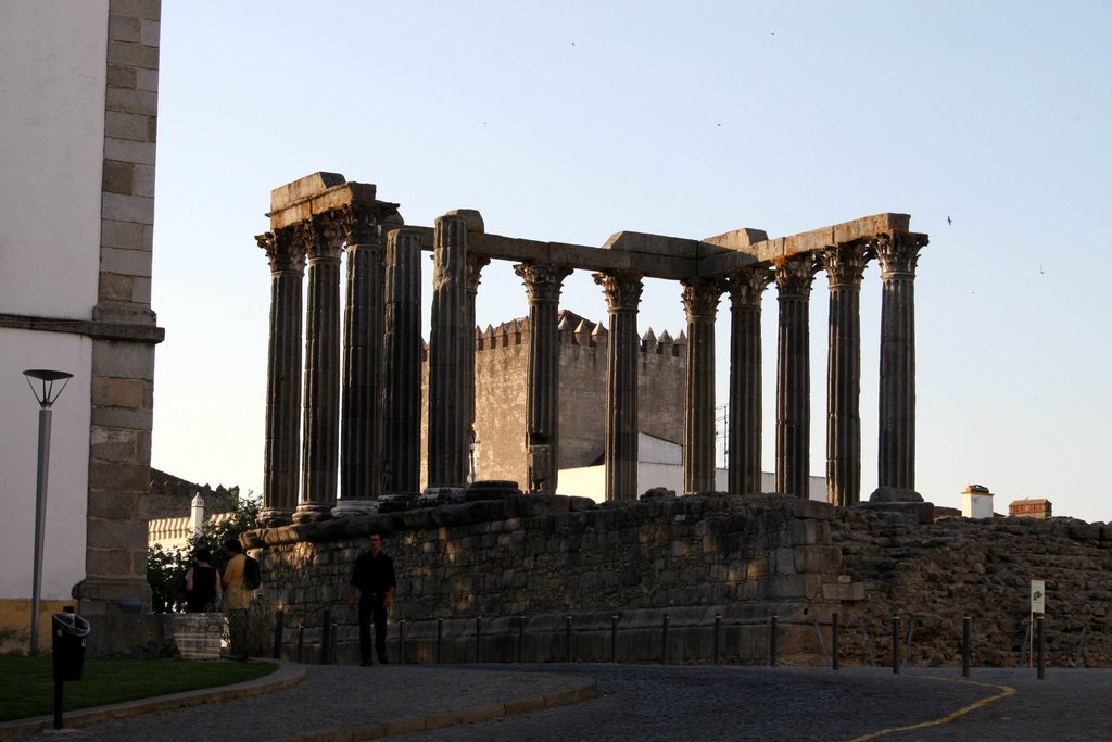
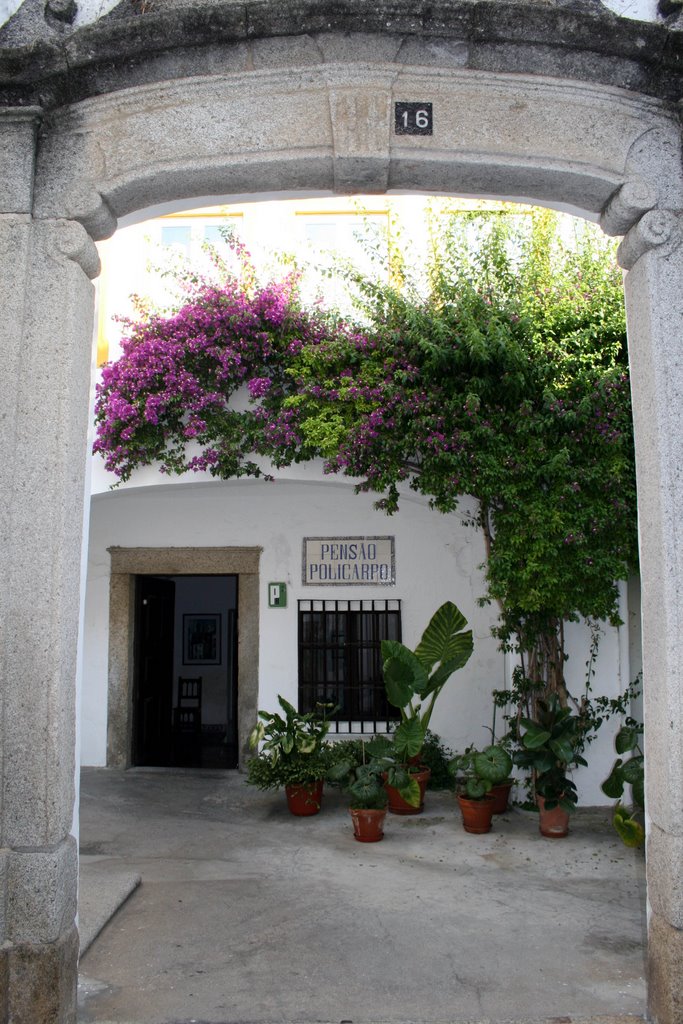
Bob attended a fine conference run by the central bank of Portugal and Sooz joined at the end of the conference. We made a circle through the midsection of the country, starting in Evora, the site of the conference, spending three days in Lisbon, two days along the coast northwest of Lisbon, then traveling east to the Spanish border at Marvao, then west again to Lisbon. We avoided the beaches of the Algarve and the mountains and wine region of the north. We concentrated on villages, ruins, and good food. Got plenty of all of them.
The major stops were in churches with affiliated monestaries and convents:
Convent of Espinheiro, Evora, now a hotel, where the conference was held
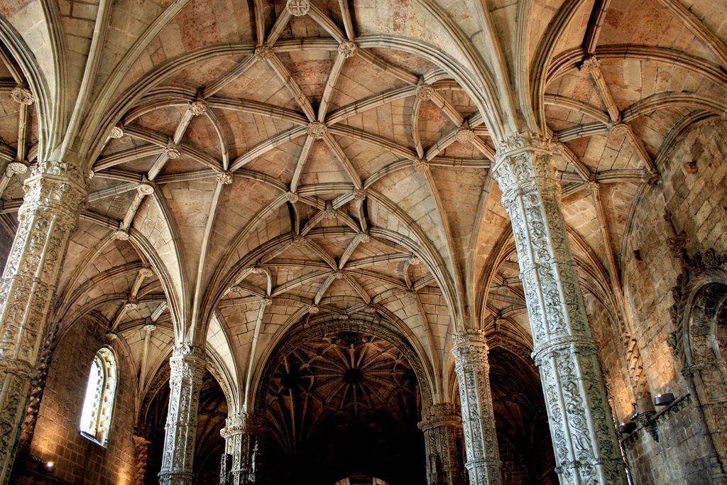
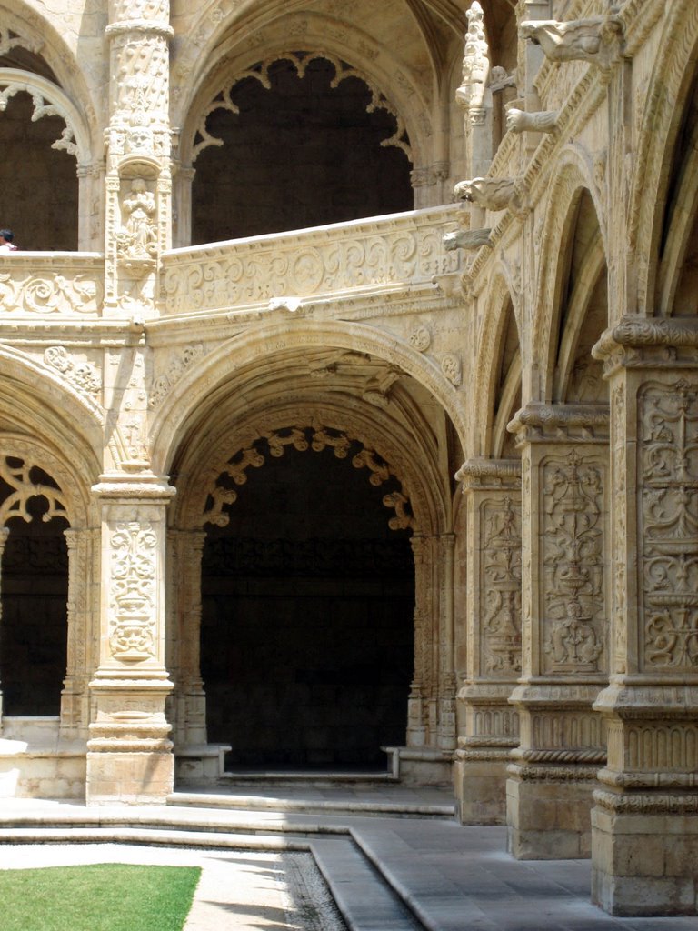
Mosteiro dos Jeronimos with Santa Maria de Belem, Lisbon
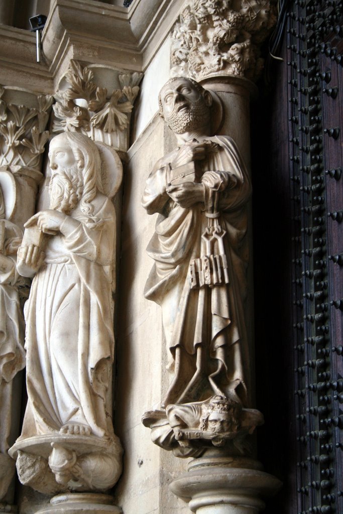
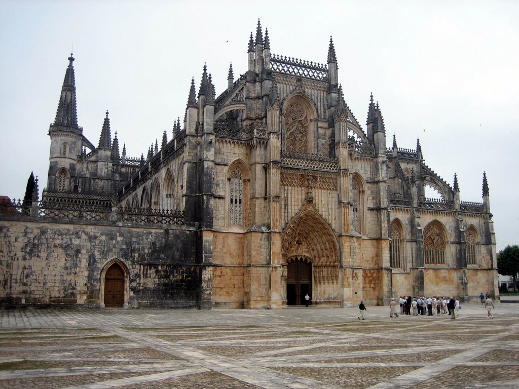
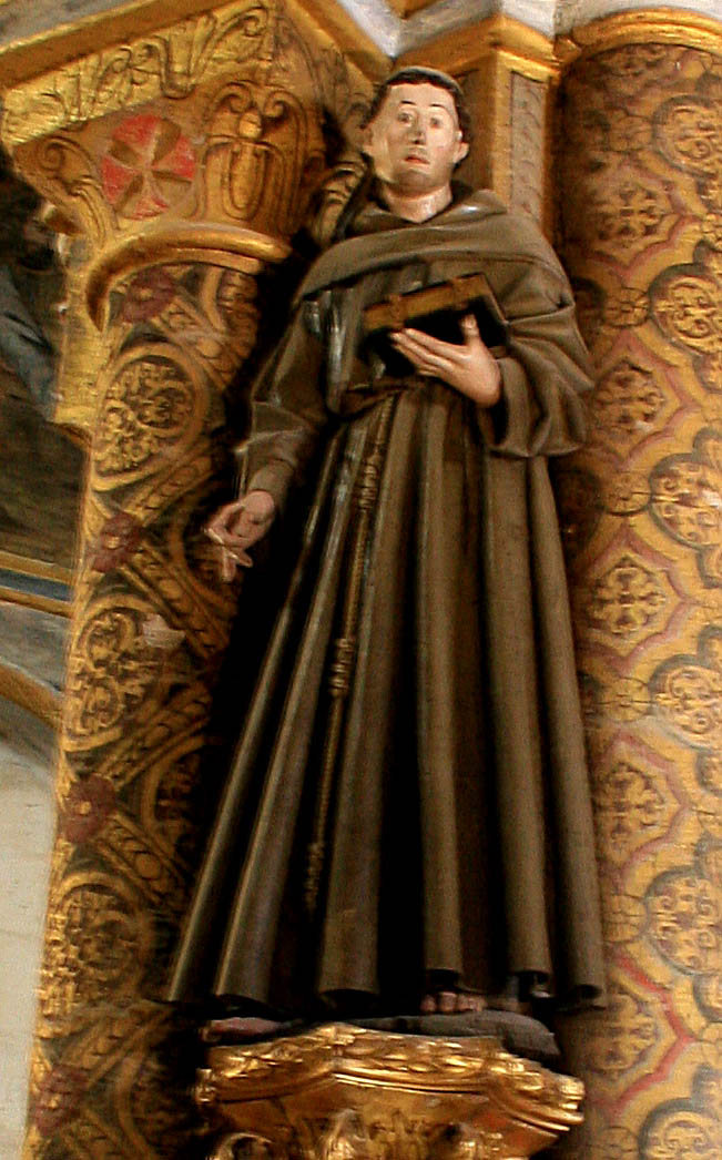
Mosteiro da Batalha
Mosteiro de Santa Maria, Alcobaca
Convento de Christo, Tomar
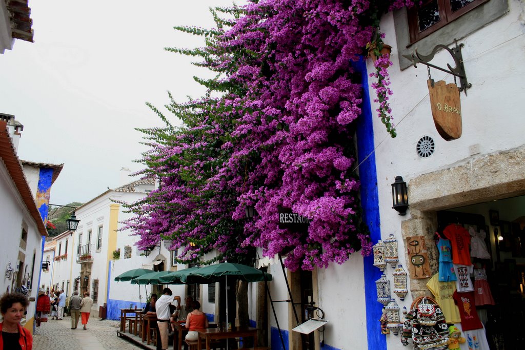
We also visited nifty hill towns, including Estremoz, Sintra, Obidos, and Marvao, the Roman ruins at Conimbriga (the best in Iberia, but not to be compared to Tunisia), and Elvas, sister city to Graceland. The hill towns all have well-preserved medieval castles, which are so common in Portugal as to merit little comment.
The major stops were in churches with affiliated monestaries and convents:
Convent of Espinheiro, Evora, now a hotel, where the conference was held
Mosteiro dos Jeronimos with Santa Maria de Belem, Lisbon
Mosteiro da Batalha
Mosteiro de Santa Maria, Alcobaca
Convento de Christo, Tomar
We also visited nifty hill towns, including Estremoz, Sintra, Obidos, and Marvao, the Roman ruins at Conimbriga (the best in Iberia, but not to be compared to Tunisia), and Elvas, sister city to Graceland. The hill towns all have well-preserved medieval castles, which are so common in Portugal as to merit little comment.


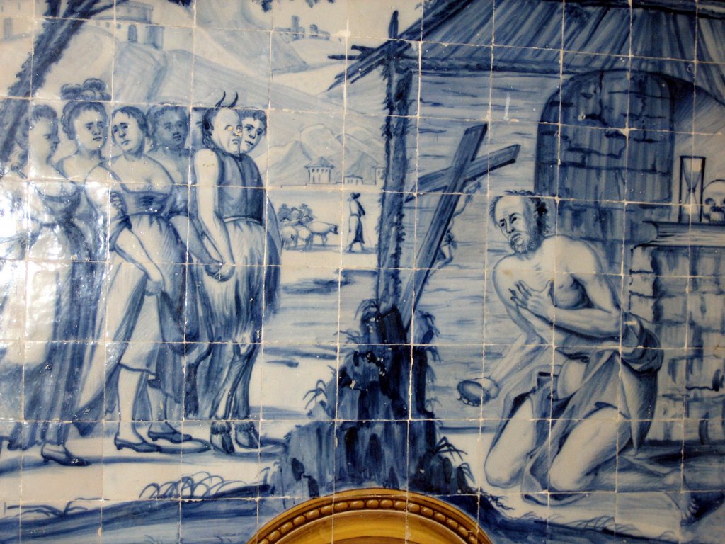 Azuletos at Espinheiro (the convent converted to hotel where the conference was held), the temptation of Saint Anthony
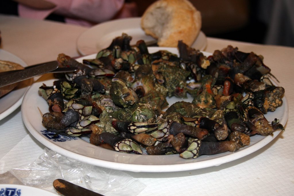 Doigts de mer, a delicacy not enjoyed since our 1995 trip to Barcelona
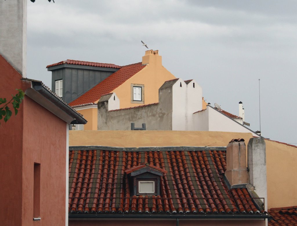 This is really a picture, not a travel poster! Lisbon, from the castelo
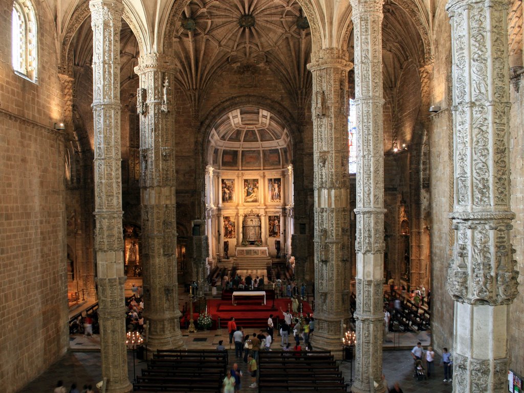
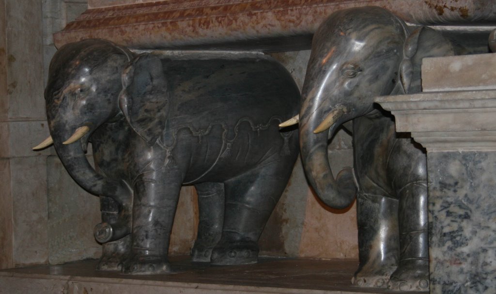 Elephants holding up a tomb in Santa Maria de Belem, reflecting Portugal's colonial role in India
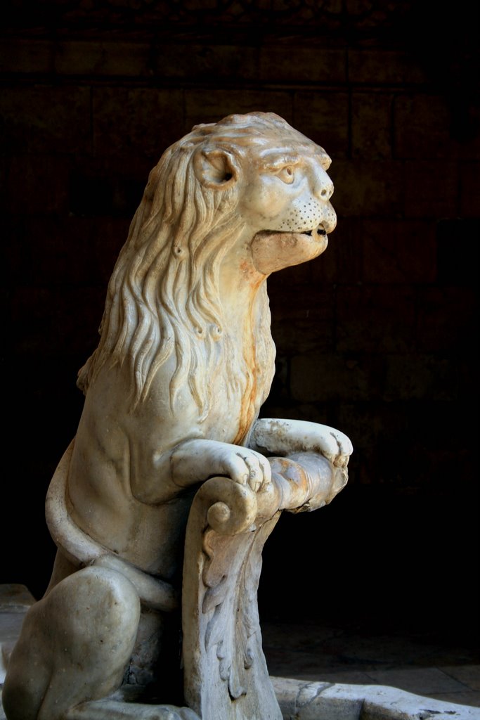


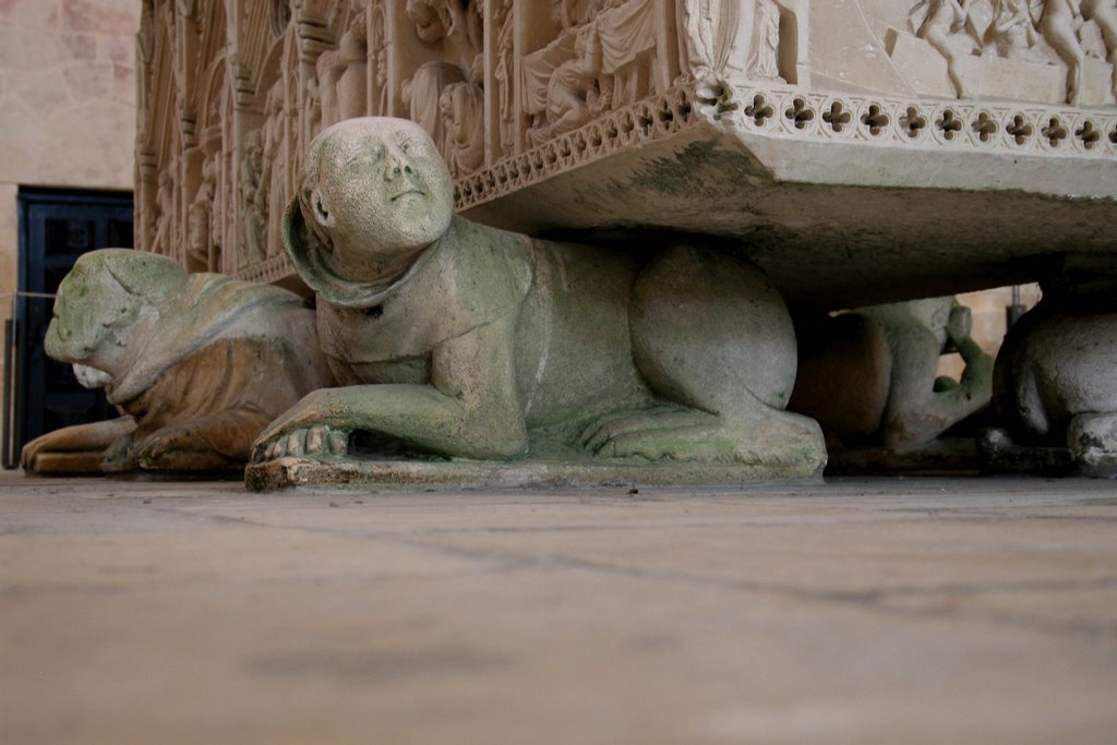
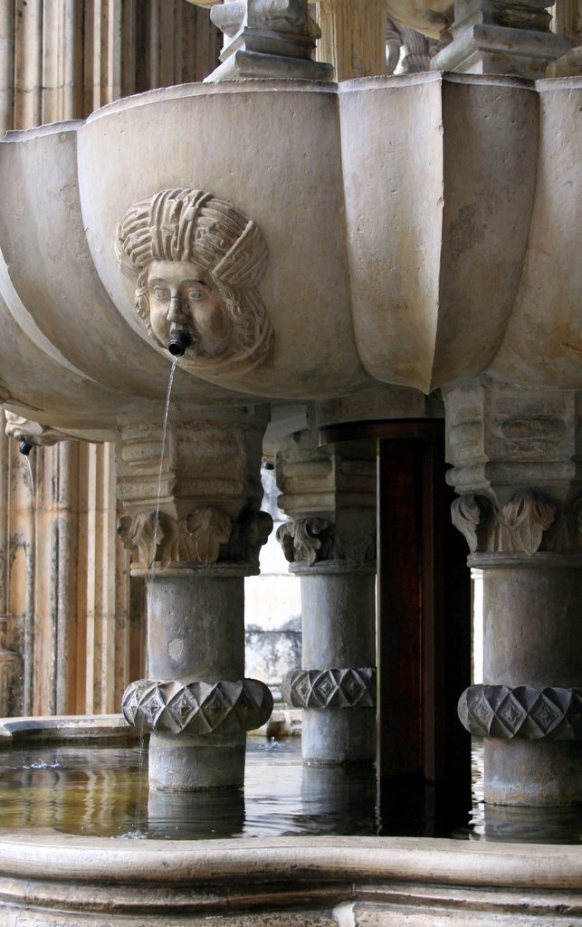
Monk-dog chimera patiently supports a tomb at Santa Maria de Vittoria, Batalha


Sunday, June 04, 2006
Sunday June 4 in Buenos Aires
Dr. Bob is on the first of his 4 days in BA for a central bank conference. He reports,
After settling at the hotel and carrying out the badly needed cleanup, I took a long walk covering most of the sights of downtown, generally following the walking tour in the Lonely Planet. But I had a terrible time navigating, as I always do in the antipodes. The first objective was the plaza of San Martin, with Big Statue (see below). I got there all right, but then my northern hemisphere misunderstanding of the sun kept bringing me back.
BA is basically a prosperous European city. It reminds me the most of Barcelona, though the numbers say it is nowhere near as rich. Lots of European brands on offer. Relatively little fast food. I was lucky to be touring on Sunday, when it is calm. Tomorrow it will be a madhouse, according to the experts.
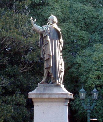
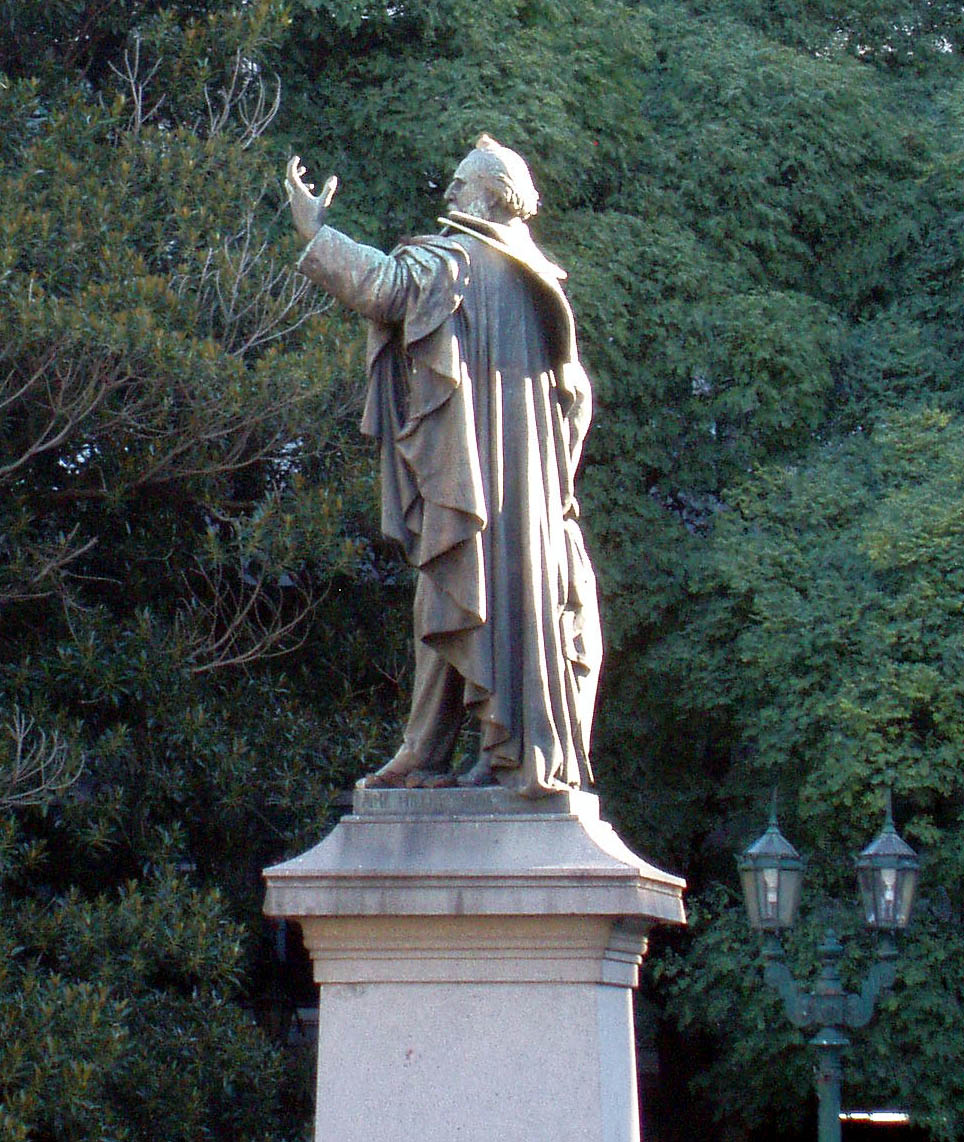
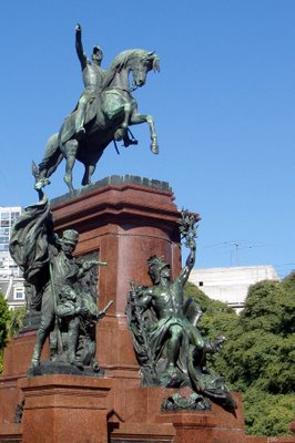 San Martin. The sun kept brining me back here.
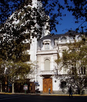
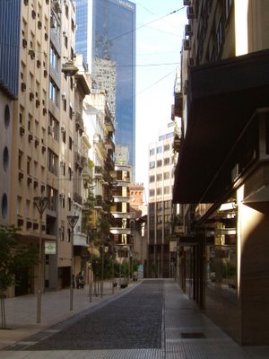
Architectural juxtaposition all over the city
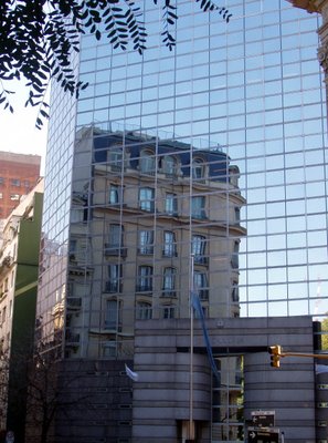 19th century building reflected
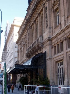
 No hesitation in blending architecture here. This is all brand new, a swank gallery near San Martin.
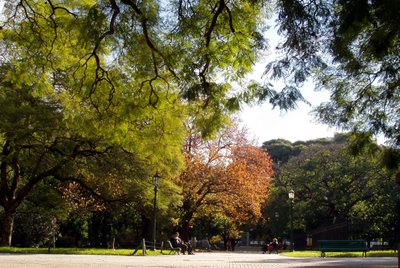 A bit of fall coloring in one of many inviting parks.

Lots of fanciful facades here.
This for Annie: The Teatro Colon, playing Cosi tonight. But I can't stay up that late.
 Conquistadors everywhere.

The hotel gave me a plate of perfect seasonal fruit. I et up the apples and pear before I thought of taking a picture. The persimmons were left.
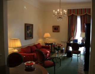 My digs at the Alvear Palace hotel. Looking from the dining room to the living room. All this and free internet too...
After settling at the hotel and carrying out the badly needed cleanup, I took a long walk covering most of the sights of downtown, generally following the walking tour in the Lonely Planet. But I had a terrible time navigating, as I always do in the antipodes. The first objective was the plaza of San Martin, with Big Statue (see below). I got there all right, but then my northern hemisphere misunderstanding of the sun kept bringing me back.
BA is basically a prosperous European city. It reminds me the most of Barcelona, though the numbers say it is nowhere near as rich. Lots of European brands on offer. Relatively little fast food. I was lucky to be touring on Sunday, when it is calm. Tomorrow it will be a madhouse, according to the experts.
 San Martin. The sun kept brining me back here.
Architectural juxtaposition all over the city
 19th century building reflected
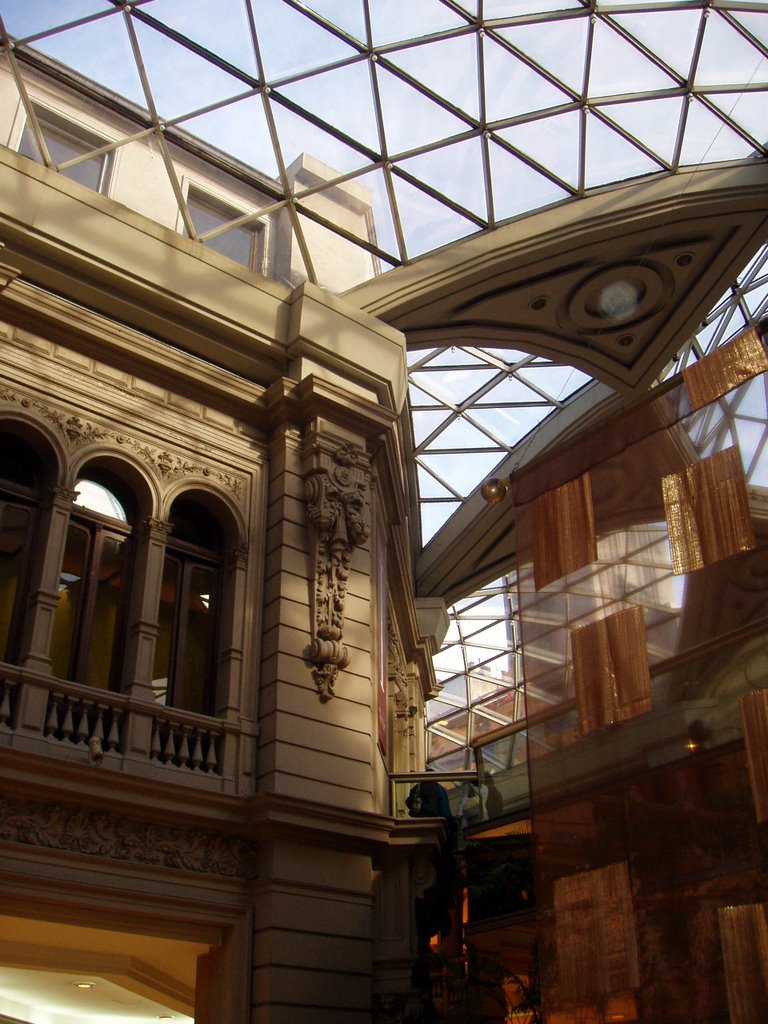 No hesitation in blending architecture here. This is all brand new, a swank gallery near San Martin.
 A bit of fall coloring in one of many inviting parks.
Lots of fanciful facades here.

This for Annie: The Teatro Colon, playing Cosi tonight. But I can't stay up that late.
 Conquistadors everywhere.
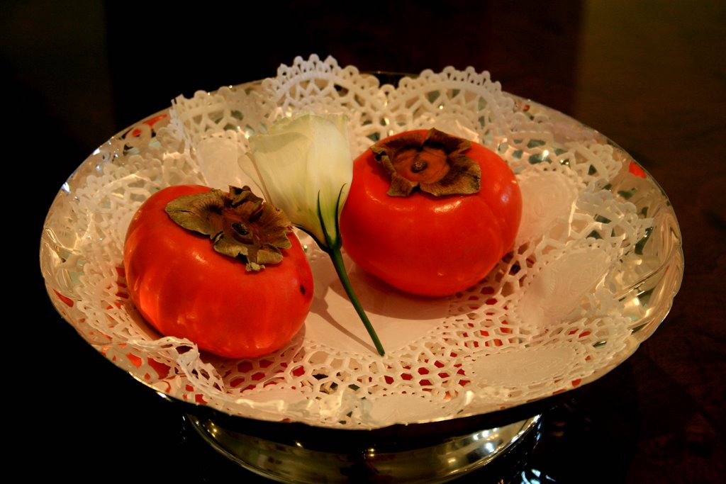
The hotel gave me a plate of perfect seasonal fruit. I et up the apples and pear before I thought of taking a picture. The persimmons were left.
 My digs at the Alvear Palace hotel. Looking from the dining room to the living room. All this and free internet too...
![]()